Skyline Hikers of the Canadian Rockies
March 12, 2020
Skyline Hikers has cancelled the camps at Molar Pass in 2020.
We faced and were conquering so many challenges this year with volunteering (you volunteered in droves), Parks Canada regulations including the new requirement to remove human waste, and much more. However, the COVID-19 virus outbreak, now a pandemic, has upended all plans for this summer. The health and safety of our members and hikers is paramount.
All cancellation fees for this year are waived, even if you cancelled before this announcement.
We have enough cash reserves to withstand this. However, our losses will be significant.
Your Executive Committee is disappointed and discouraged and shares your concerns. We sincerely apologize for any inconvenience this may cause you.
Thank you for your support and understanding,
Robert Vanderzweerde (President/Treasurer)
Michael Taylor (Vice-President)
Craig Hazle (Past President)
Barry Duncan (Registrar)
Wendy Calvert (Secretary)
Cheryl Olson (Liaison Committee Chair)
Judith Taylor (Marketing & Publicity Committee Co-Chair)
Teresa Boyer (Membership Committee Chair)
Beverley Mulholland (Volunteer Committee Chair)
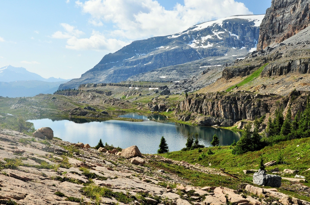
Our 2020 camp at Molar Pass is a favourite location inside the Banff National Park amongst many Skyline Hikers which was last visited in 2010 (see video below).
This year’s camp dates are:
- July 13 to 18
- July 20 to 25
- July 27 to August 1
- August 3 to 8
- August 10 to 15
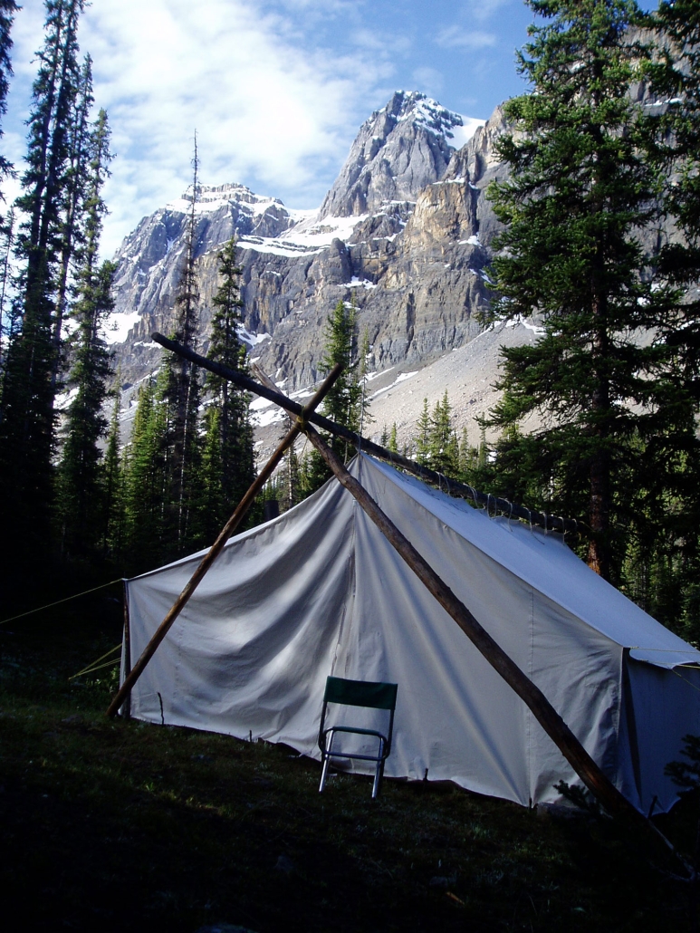
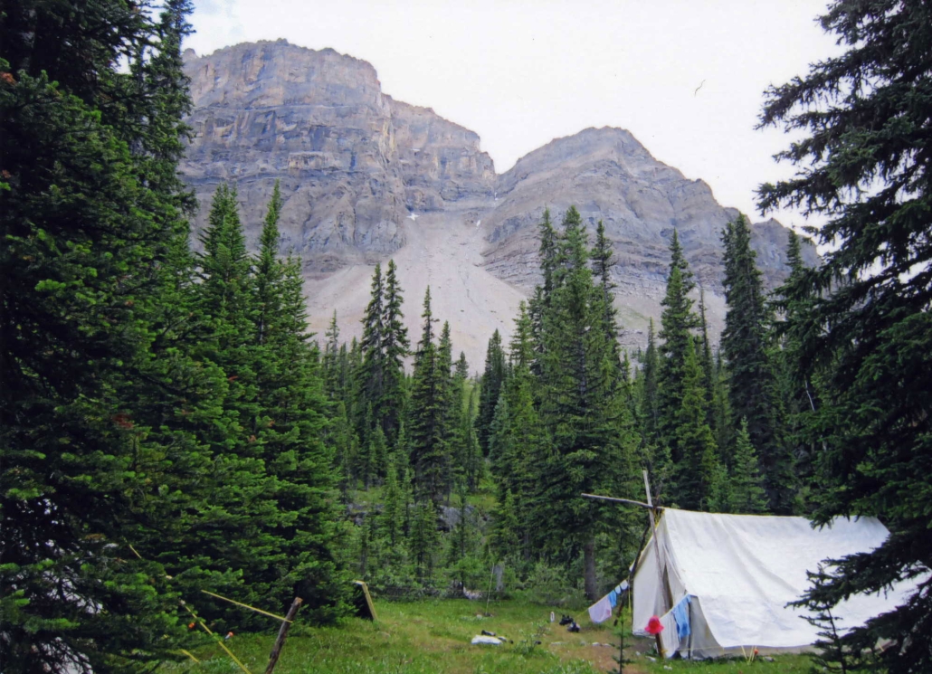
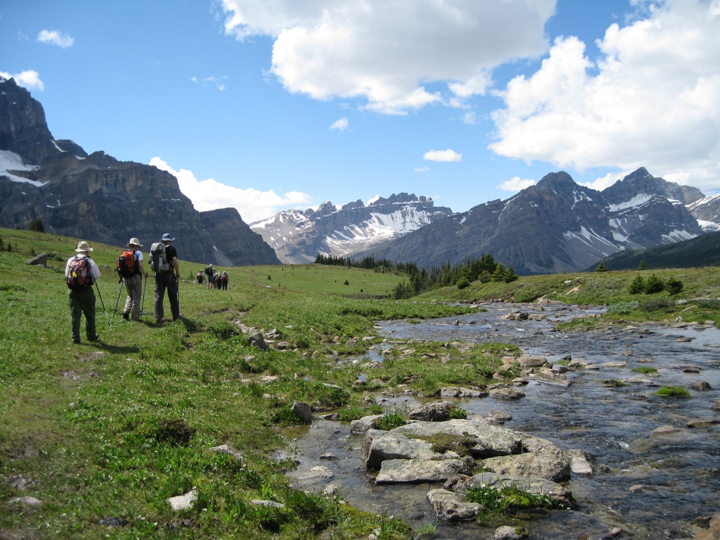
The camp is located on a small secondary creek in a broad valley. There are spectacular views of the mountains right from the camp.
The moderate trail into camp starts at the Mosquito Creek trailhead on the Icefields Parkway and is about 7 km in length. It starts with a brief climb along Mosquito Creek. Once past this initial climb, the valley broadens with sweeping views of the surrounding mountains and the remainder of the hike into camp is relatively easy. Overall elevation gain is 250 metres.
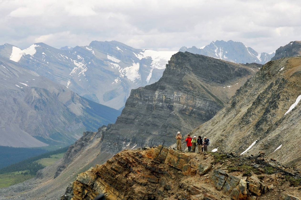
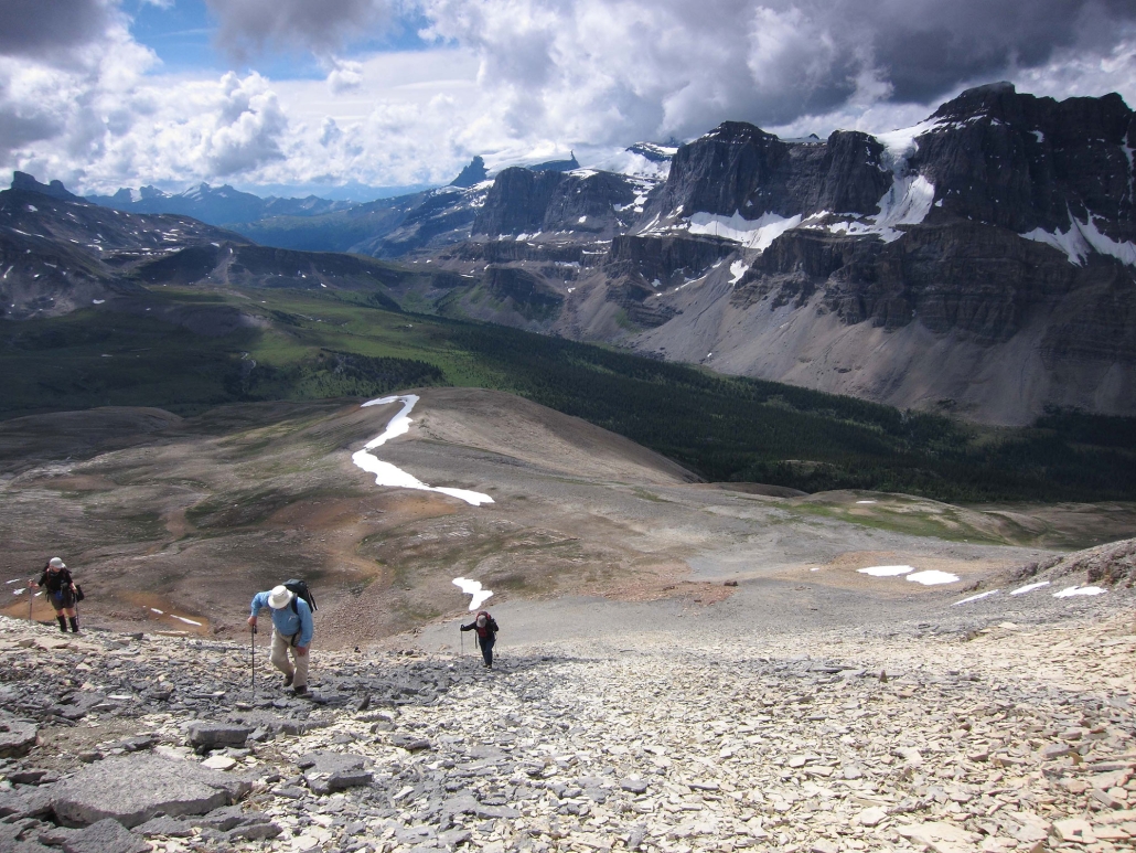
A choice of 5 or 6 hikes will be offered each day from camp. Each day hike is led by a volunteer leader. Hikers should be prepared to hike over rough trails (many above the tree line) for 5 to 25 km per day with elevation gains of 200 to 1000 meters. Hike times average 6 to 7 hours per day including stops.
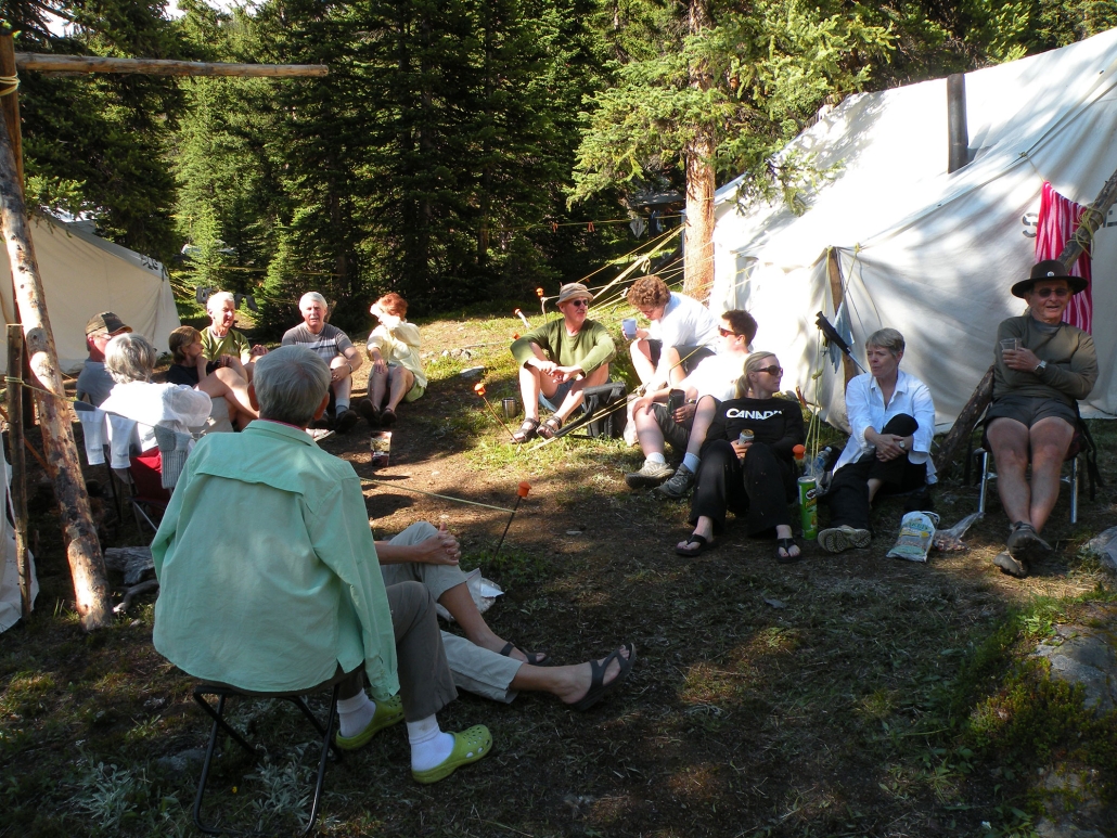
Camp life provides an interesting contrast to the peacefulness of the trail. Meal times in the dining tent are happy, noisy affairs. The camaraderie continues around the evening campfire where descriptions of hikes planned for the following day are given. It is also a time for singing, recounting of the day’s events and telling of tall tales.
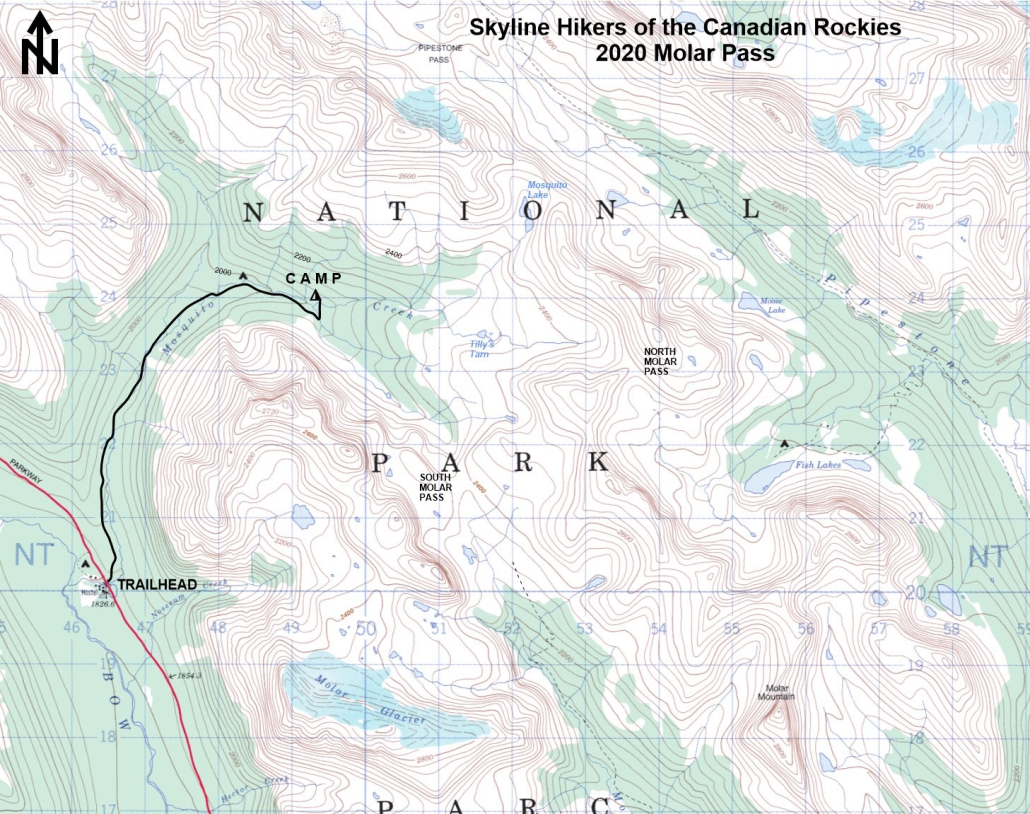
Maps
Topographical Map References:
Hector Lake, Map Reference 082N09 (or 82 N/9), Scale 1:50,000
Gem Trek maps:
Bow Lake & Saskatchewan Crossing, Scale 1:70,000
Shown below is a topographical map from the Government of Canada’s GeoGratis service (used under licence). Click on the map to see a larger image.
YouTube

Meetup