Skyline Hikers of the Canadian Rockies
2015 at Palliser Pass
Our 2015 camp was located in a wilderness area at the south end of Banff National Park. Skyline Hikers visited this location in 2006 (see video gallery) and in 1975.
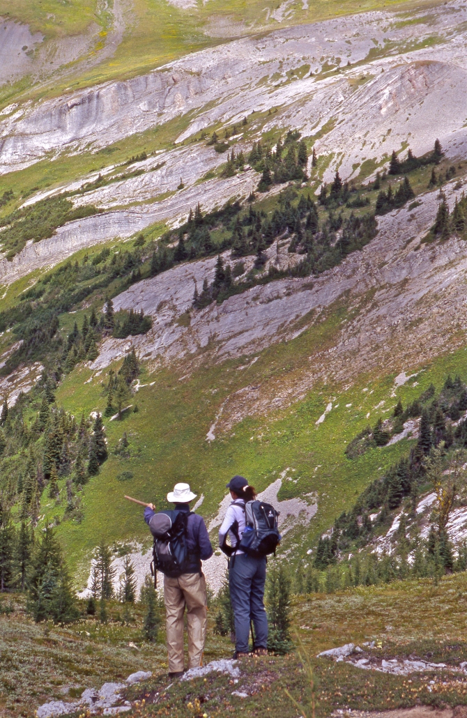
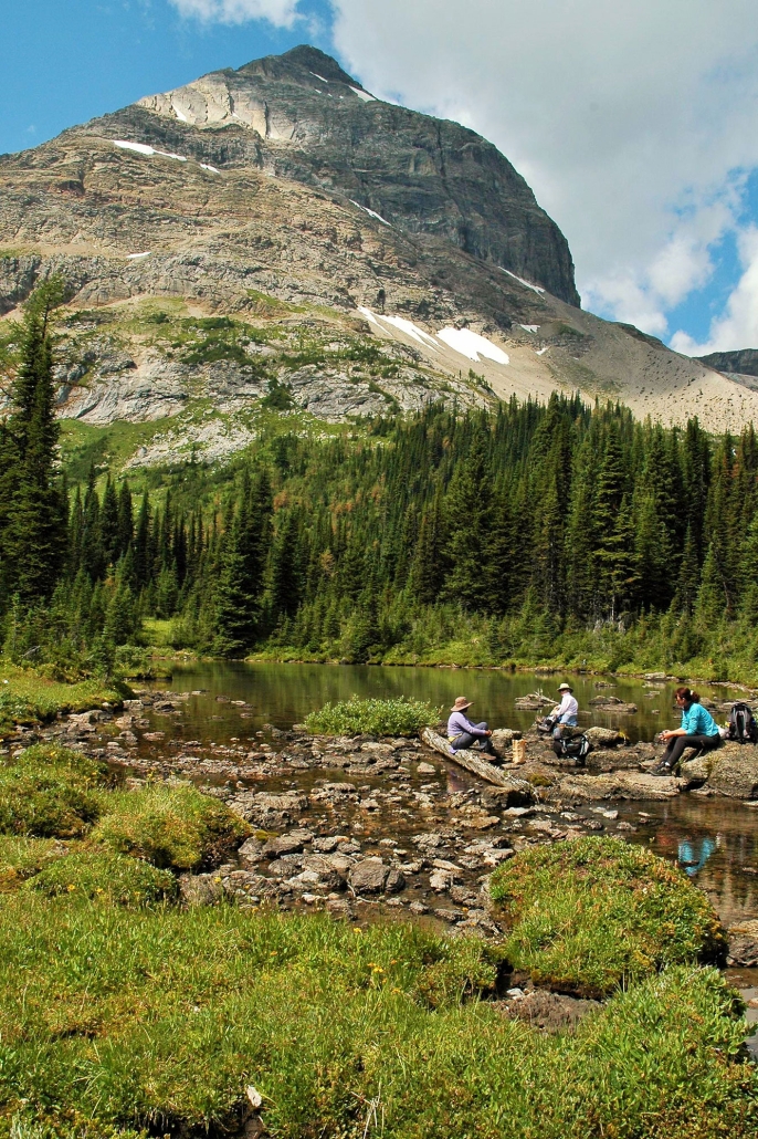
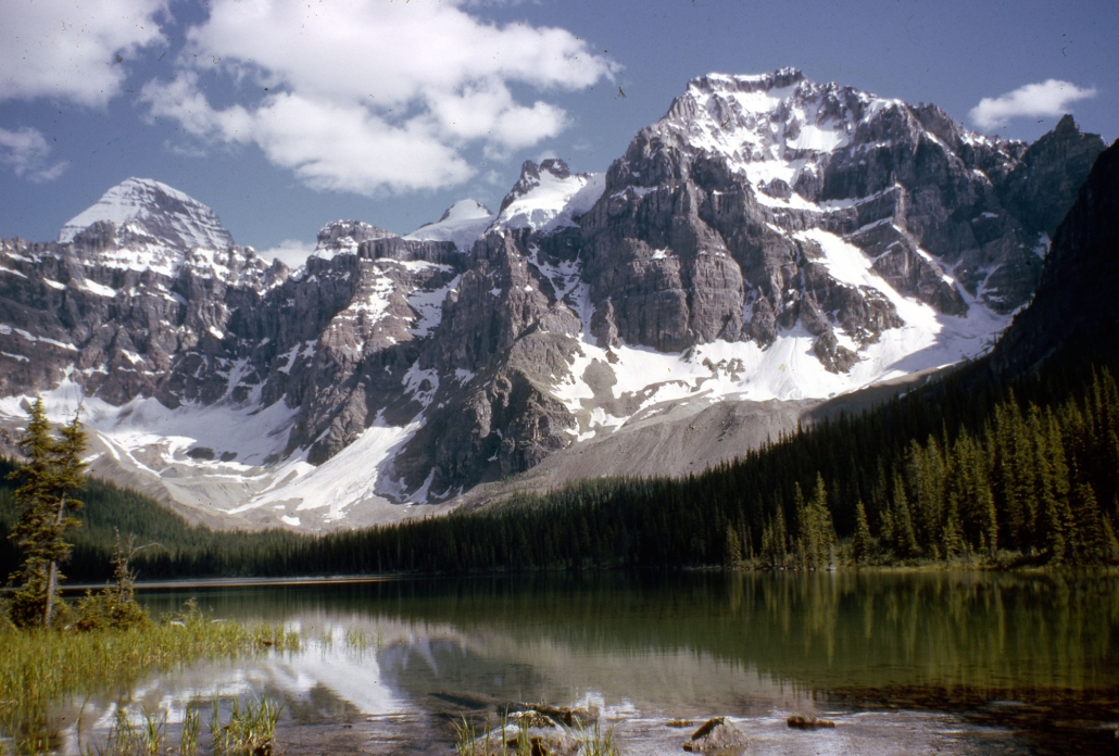
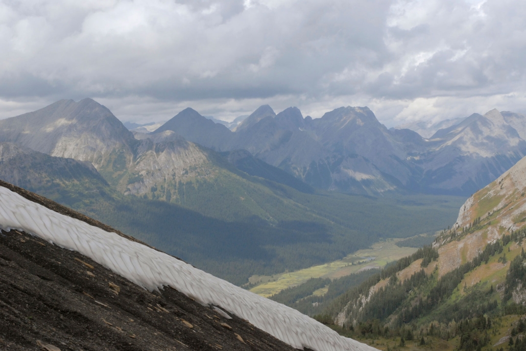
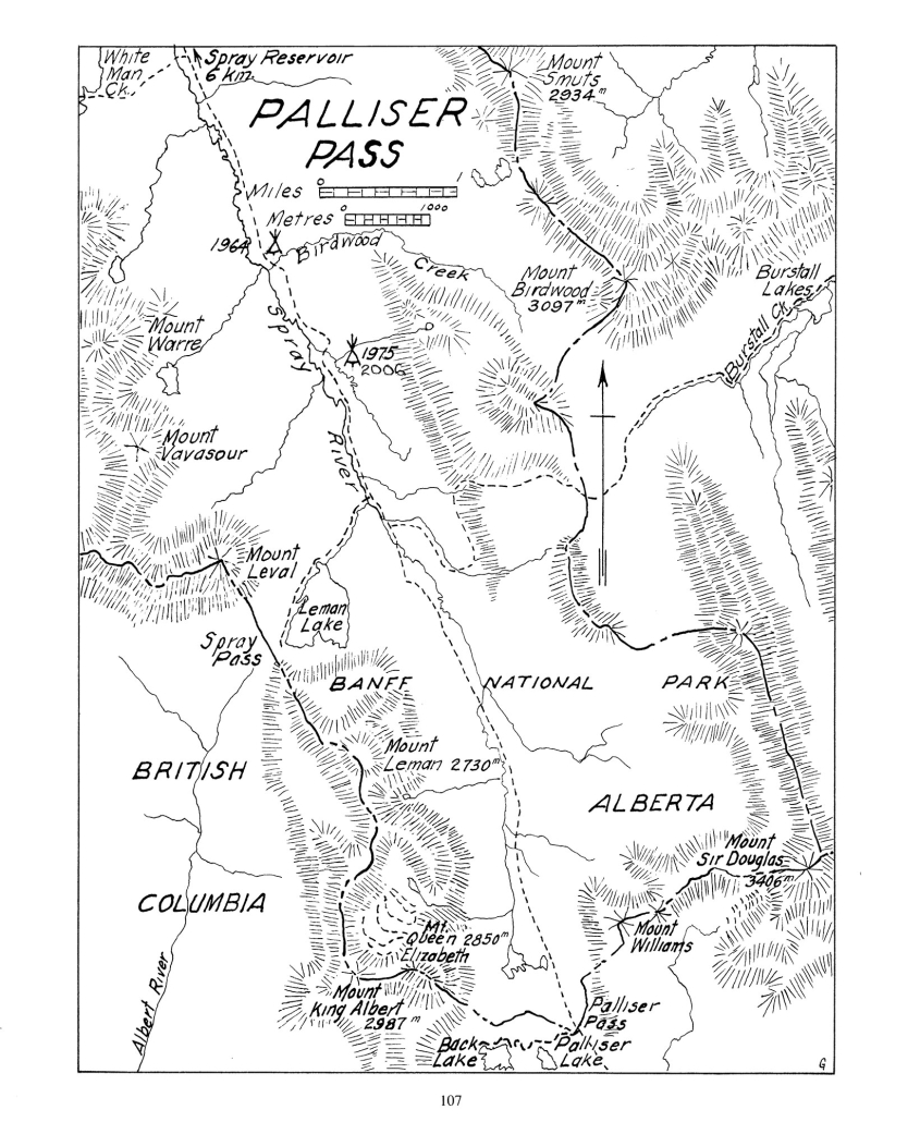
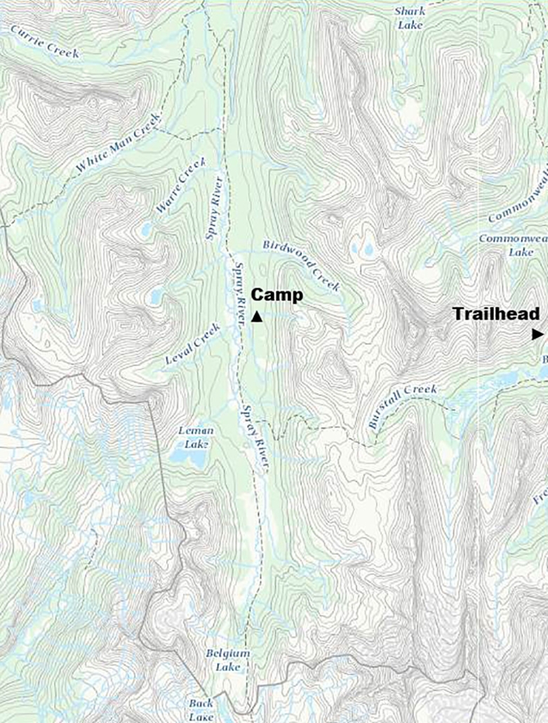
The campsite was just below Mount Birdwood in a clearing on a small creek at 1960 meters elevation (6400′). Our campsite in the valley was surrounded mountains Shark, Smuts, Warre, Vavasour and Leval (pictured below). The camp provided easy access to Leman Lake (pictured below) and a superb view of the Albert River Mountains from Spray Pass. The beautiful Palliser Pass area was located 7 km south of the camp.
The 2015 camp dates were:
- July 13 to 18
- July 20 to 25
- July 27 to August 1
- August 3 to 8
- August 10 to 15
From the Mt. Shark parking lot on the Smith -Dorrien-Spray Trail, it was a 18.0 km hike up the Spray River. The elevation gain was negligable.
The Palliser location was in the southern tip of Banff National Park but the proposed hikes also accessed Kananaskis Country (Peter Lougheed Provincial Park) via Burstall Pass, as well as British Columbia through White Man, Spray, and Palliser Passes. These three passes are all on the Continental Divide which forms the boundary between Alberta and British Columbia. These passes are also the headwaters for creeks flowing into the Spray River system draining to the north and east into the Bow River. The drainage to the west side of these passes forms the headwaters of the Cross, Albert and Palliser Rivers flowing west and southwest into the Kootenay River system.
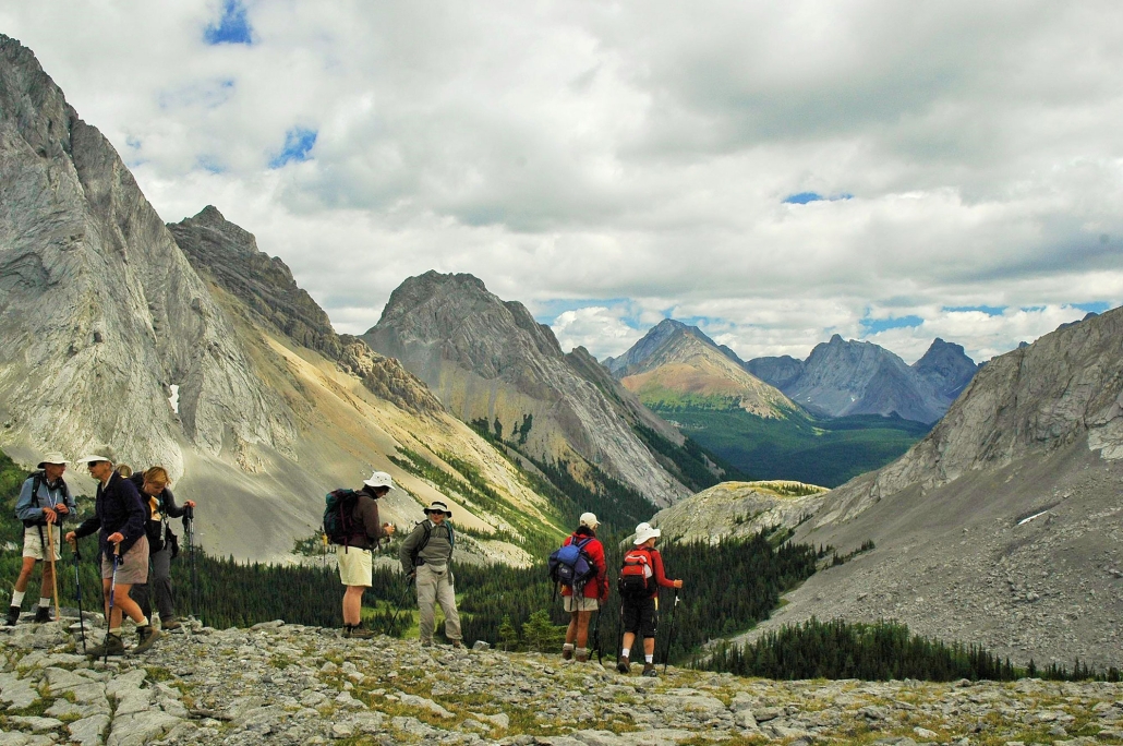
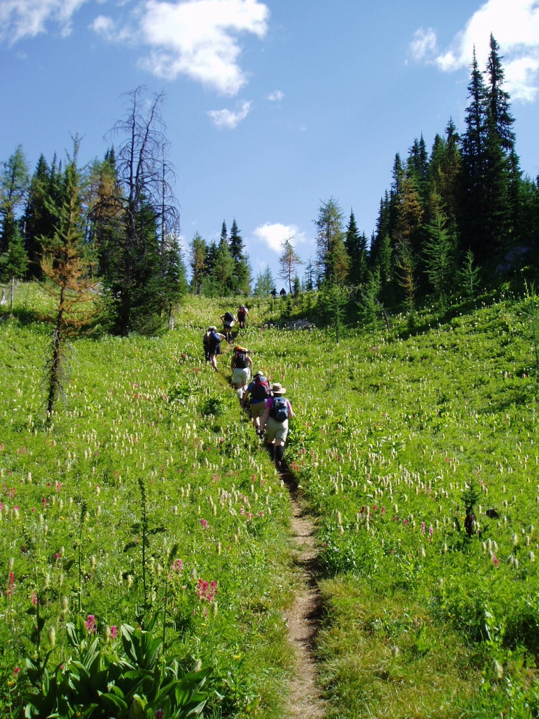
A choice of 5 or 6 hikes was offered each day from camp. Each day hike was led by an experienced volunteer leader. Hikers were prepared to hike over rough trails (many above the tree line) for 5 to 25 km per day with elevation gains of 200 to 1000 meters. Hike times averaged 6 to 7 hours per day including stops.
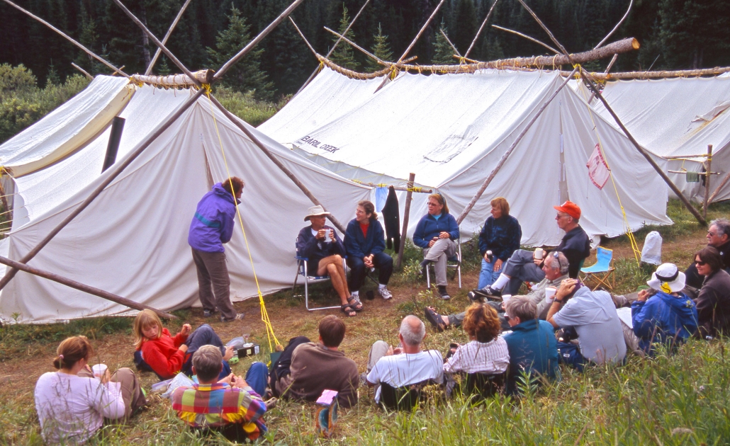
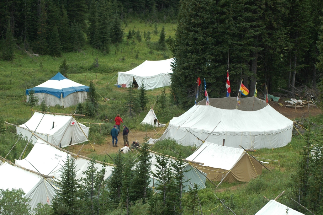
Camp life provided an interesting contrast to the peacefulness of the trail. Meal times in the dining tent were happy, noisy affairs. The camaraderie continued around the evening campfire where a description of hikes planned for the following day were given. It was also a time for singing, recounting of the day’s events and telling of tall tales.
Maps
Topographical Map References:
- Kananaskis Lakes 82 J/l1
- Spray Lakes 82 J/l4
Gem Trek maps:
- First choice: Kananaskis Lakes, Scale 1:50,000
- Second choice: Banff & Mount Assiniboine, Scale 1:100,000
Shown below are the map handout used by Skyline Hikers in 1975 (which also shows both the 1964 and 1975 camp locations) and a topographical map from the Government of Canada’s GeoGratis service (used under license). Click on either map to see a larger image.
History of the Area
Palliser Pass (2088m /6850 ft), Lake, and River were named after Captain John Palliser (see picture) who was the leader of the Palliser Expedition which explored the prairies and southern Rockies from 1857 to 1860. Can you imagine approaching the front ranges of the Rockies with no map of any kind and nearly all of the features unnamed? Palliser split his expedition into three groups. Lt. Thomas Blakiston went south into Waterton; Dr. James Hector explored the Bow Valley, Vermillion Pass and Kicking Horse Pass, the North Saskatchewan and Athabasca River regions. Palliser travelled to the headwaters of the Kananaskis River and went down the Palliser River to the Kootenay River valley. The Palliser Expedition produced some of the first maps of these mountain areas and named many of the prominent features.
Spray Pass (1935m /6350 ft), River, and Lakes carry a descriptive name associated with swiftly moving water.
White Man Pass (2149m / 7050 ft) (also known as Cross Pass) was named by Palliser in 1858. Father Jean de Smet had crossed this pass in 1845 and may have been the white man the natives referred to in conversation with Captain Palliser. It could also have been the white men in James Sinclair’s Red River group of immigrants that traversed the pass earlier in 1841. Father de Smet built a “Cross of Peace” at the summit of the pass; hence the name of Cross Lake near the pass and the Cross River west of the pass. White Man Mountain, 2977m /9768 ft , is on the south side and Red Man Mountain, 2905m / 9531 ft, is on the north side of White Man Pass.
The majority of the peaks and lakes in this area were named by the Interprovincial Boundary Commission Survey team who surveyed the 1000 kilometre long Continental Divide between 1913 and 1924. These men were working in the peace and beauty of the Rockies while many of their friends, relatives, and former co-workers were among the troops fighting the horrific battles of WW1 in Europe. Patriotism was high during and following WW1 and many names relate to this conflict commemorating military people, battlegrounds, and warships.
R.W. Cautley was the Alberta representative on the survey and was responsible for detailed work in and near the passes. The British Columbia representative was Arthur Wheeler who mapped the high mountains between the passes. Wheeler was co-founder of the Alpine Club of Canada. He probably saw more of the Canadian Rockies than any other person with the boundary survey and four decades in the Alpine Club.

YouTube

Meetup