Skyline Hikers of the Canadian Rockies
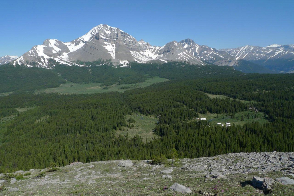
Our 2019 camp was at Sunset Pass which is north of the Saskatchewan River Crossing on the Icefields Parkway in Banff National Park. This is a beautiful site and was last visited in 2012 and 2007 (see videos in the Galleries).
The year’s camp dates were:
- July 15 to 20
- July 22 to 27
- July 29 to August 3
- August 5 to 10
- August 12 to 17
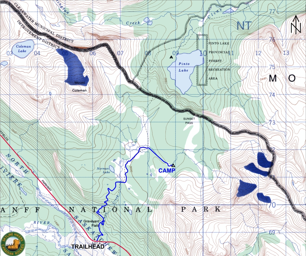
The camp was located in the valley between Mount Coleman and Mount Wilson. The camp site straddles Norman Creek which has several excellent places for swimming.
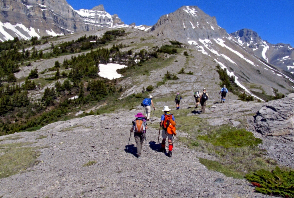
The moderate trail into camp started at the Sunset Pass trailhead on the Icefields Parkway and was about 7 km in length. It started with a 500 meter climb along Norman Creek with lookouts into the gorge and waterfalls. Once past this initial climb, the valley broadened with sweeping views of the surrounding mountains and the remainder of the hike into camp was relatively easy with 100 meters of elevation gain.
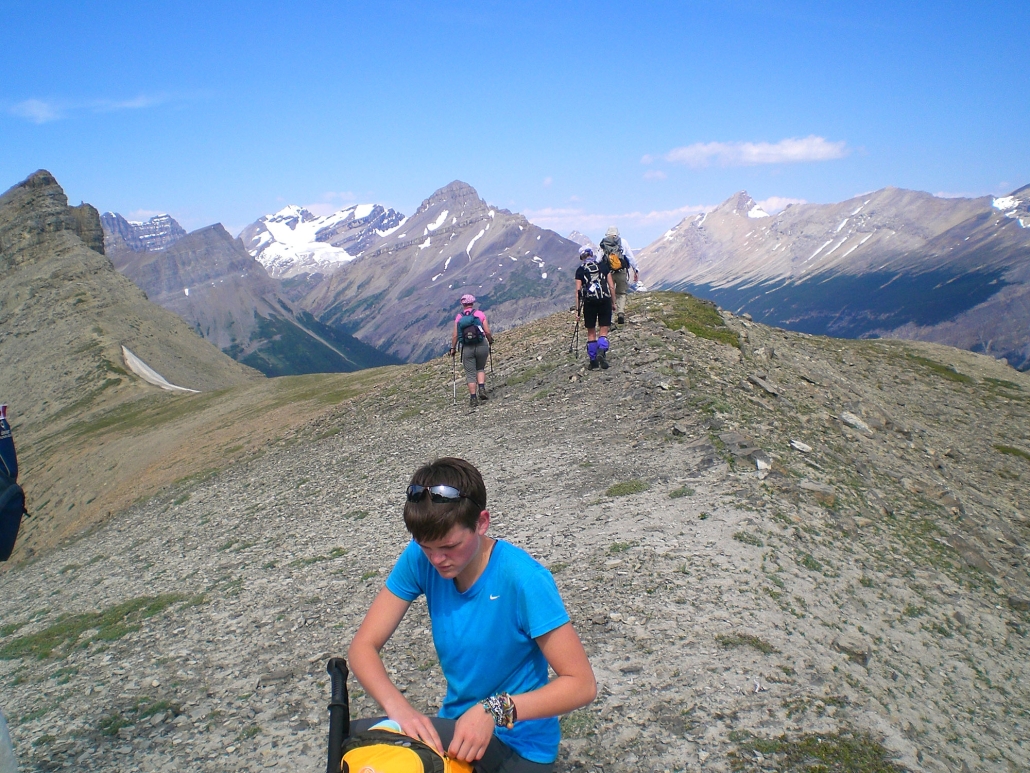
A choice of 5 or 6 hikes were offered each day from camp. Each day hike was led by a volunteer leader. Hikers were prepared to hike over rough trails (many above the tree line) for 5 to 25 km per day with elevation gains of 200 to 1000 meters. Hike times averaged 6 to 7 hours per day including stops.
Camp life provided an interesting contrast to the peacefulness of the trail. Meal times in the dining tent were happy, noisy affairs. The camaraderie continued around the evening campfire where a description of hikes planned for the following day were given. It was also a time for singing, recounting of the day’s events and telling of tall tales.
Maps
Topographical Map References:
- Cline River 83 C/2
Gem Trek maps:
- Bow Lake & Saskatchewan Crossing, Scale 1:70,000
Shown below is a topographical map from the Government of Canada’s GeoGratis service (used under license). Click on the map to see a larger image.
YouTube

Meetup